

WRATH
A long-endurance autonomous system built for persistent surveillance and tactical missions.
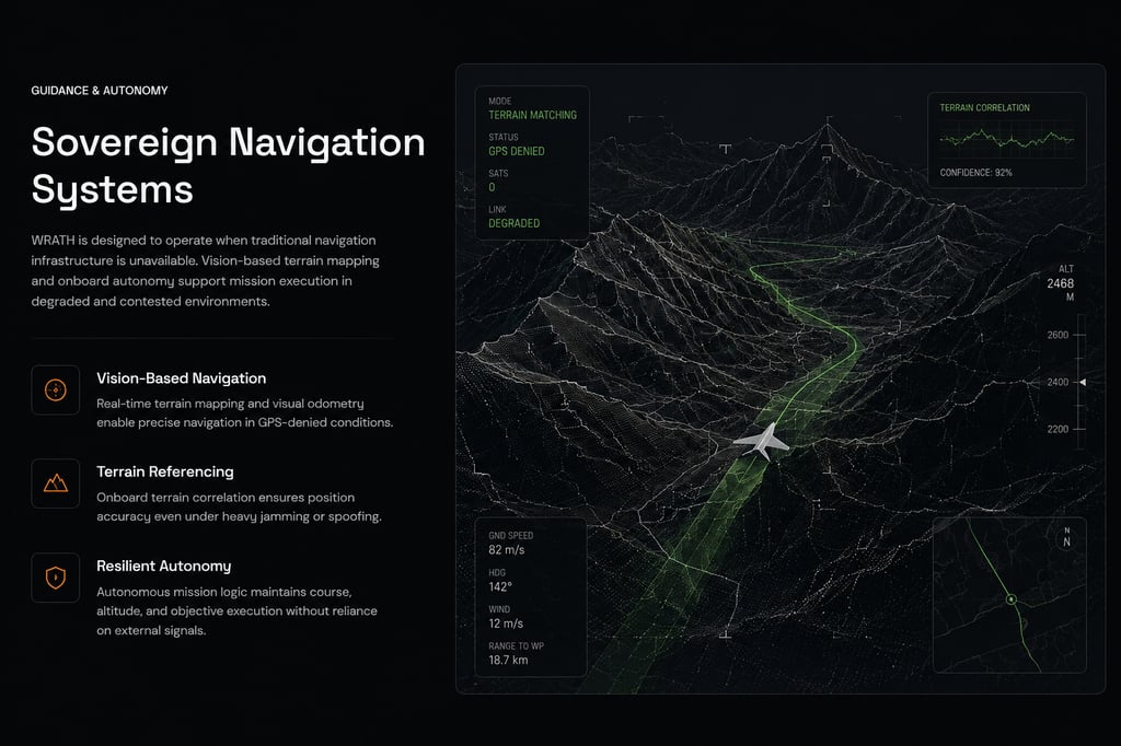
Sovereign Navigation Systems
WRATH is designed to operate in environments where satellite navigation cannot be relied upon. Vision-based terrain mapping and onboard mission logic enable continued navigation under degraded communications and GNSS-denied conditions.

Operational Parameters
Long Endurance
Terrain Mapping
Modular Payload Architecture
Designed for persistent mission profiles across large operational areas, enabling extended reconnaissance and surveillance missions.
Terrain-referenced navigation and onboard autonomy support operation in degraded and GPS-denied environments.
Flexible payload integration enables adaptation for reconnaissance, communications, sensing, and mission-specific requirements.
Interested in WRATH
For partnership inquiries, technical discussions, and platform information, contact our team.